Landfill
Assessment
Capping Thickness · Boundary Mapping · Leachate Migration
Multi-Method
Approach
Landfills pose significant environmental risks — including groundwater contamination from leachate and potential structural failures. Geophysical surveys provide a non-invasive way to study these sites, especially useful for older sites with incomplete records.
Combining multiple geophysical methods comprehensively maps landfill characteristics and enhances accuracy. Regular monitoring tracks changes over time, ensuring environmental compliance.
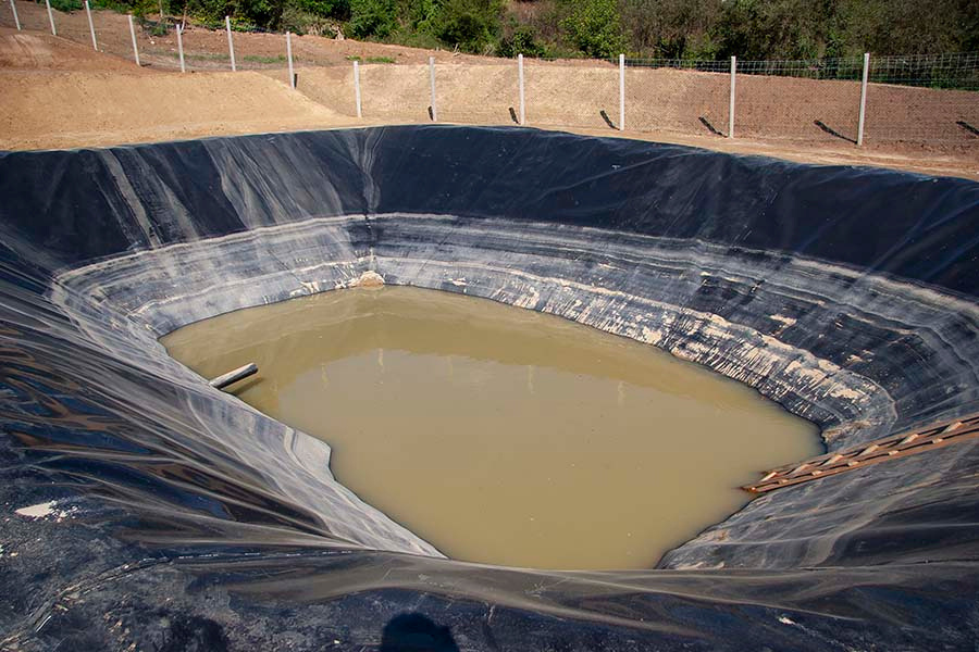
Non-invasive methods are essential for old landfills — conventional drilling risks breaching capping layers and releasing gases.
| Method | Leachate | Boundary | Clay Cap |
|---|---|---|---|
| Electrical Resistivity (ERI) | ✓✓✓ | ✓✓ | ✓✓✓ |
| Electromagnetic (EM) | ✓✓ | ✓✓✓ | ✗ |
| Ground Penetrating Radar | ✗ | ✓✓ | ✓ |
| Seismic Methods | ✗ | ✓ | ✓✓ |
ECa Conductivity
Mapping
Leachate is the liquid percolating through landfill waste that carries contaminants threatening groundwater. ERI detects areas of lower electrical resistivity caused by the conductive nature of leachate.
Leachate plume mapping identifies the movement and spread of contaminants — revealing pathways, impacted areas, and temporal changes — enabling targeted remediation.
- Map lateral and vertical extent of waste body
- Identify groundwater migration pathways
- Detect metallic debris and buried objects
- Assess clay cap integrity without drilling
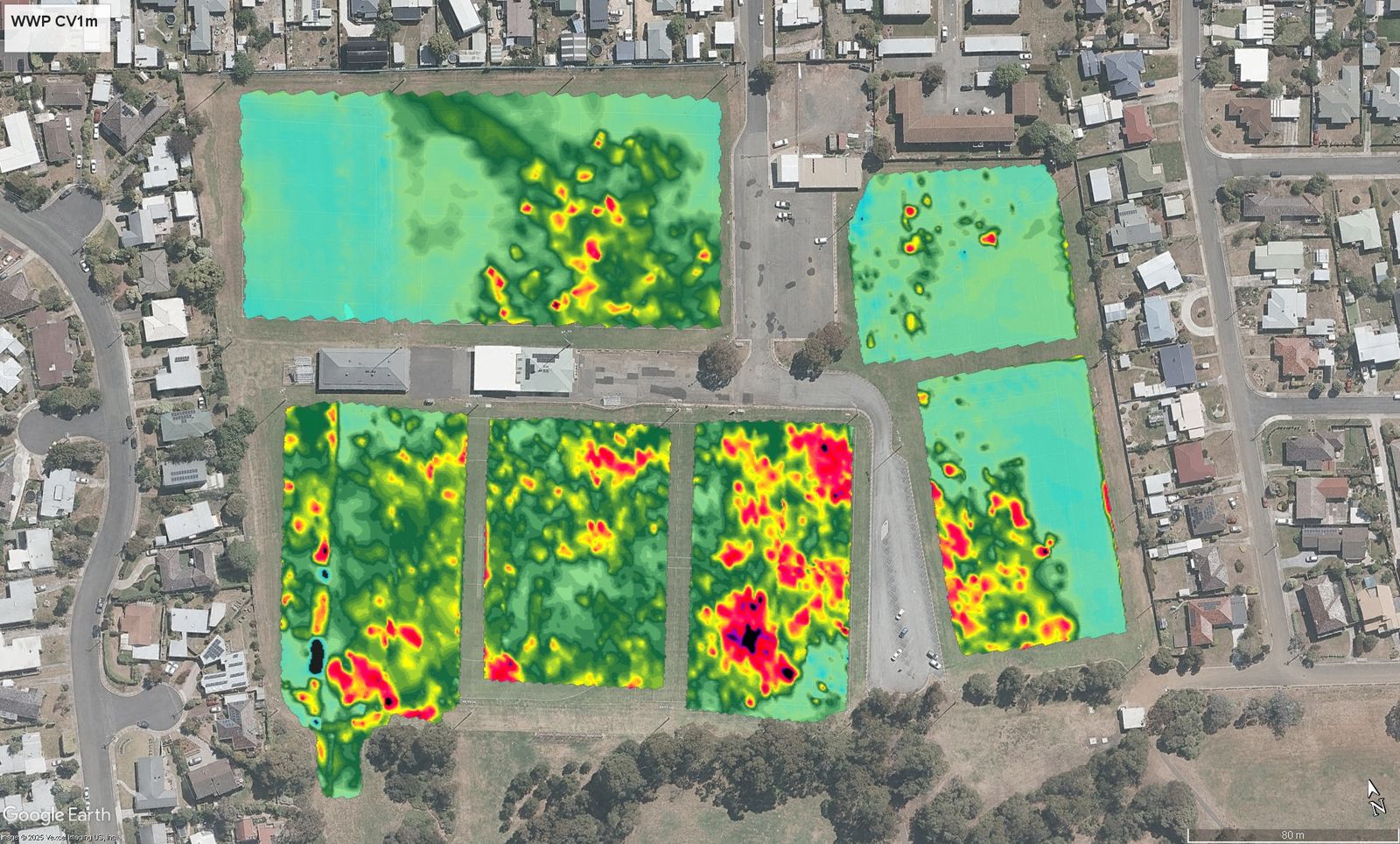
Apparent conductivity (ECa mS/m) highlighting elevated conductivity levels and indicating landfill extent.
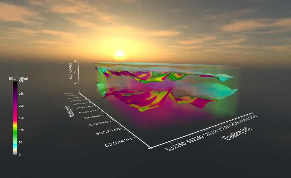
3D ECa isosurface model — multiple surfaces generated for discrete conductivity values, visualising the full landfill volume.
Old Howrah Tip
Tasmania
The Old Howrah Tip operated from 1961–1969, receiving uncontrolled domestic waste, construction materials, agricultural waste and used oils before decommissioning.
Following residential development adjacent to the site, a comprehensive non-invasive investigation was commissioned to map the waste extent, contamination risk and groundwater migration pathways.
Areas We
Serve in Tasmania
Spaulding Geophysics provides landfill characterisation services across Tasmania, from Hobart and Launceston to regional centres, coastal towns, and remote communities statewide.
Spaulding Geophysics delivers on-site landfill characterisation across all of Tasmania — including Hobart, Launceston, Devonport, Burnie, Ulverstone, George Town, Longford, Deloraine, Smithton, Wynyard, Bicheno, St Helens, Scottsdale, Queenstown, Huonville, Kingston, Kettering, Bruny Island and surrounding communities. Remote and regional sites welcomed.