Electro-
magnetics
FDEM · EMI Terrain Mapping · ECa · Conductivity
Frequency-Domain
Electromagnetics
Electromagnetic Induction (EM) terrain mapping is a non-invasive geophysical method to image the subsurface at designated depths using ground conductivity and magnetic susceptibility measurements.
A transmitter coil Tx energised by alternating current generates a time-varying primary magnetic field (Hp). This induces eddy currents in the earth generating a secondary magnetic field (Hs). The ratio Hs/Hp is linearly proportional to terrain bulk electrical conductivity (ECa).
ECa is the reconnaissance method of choice — it provides rapid large-area conductivity maps that guide all subsequent targeted investigations.
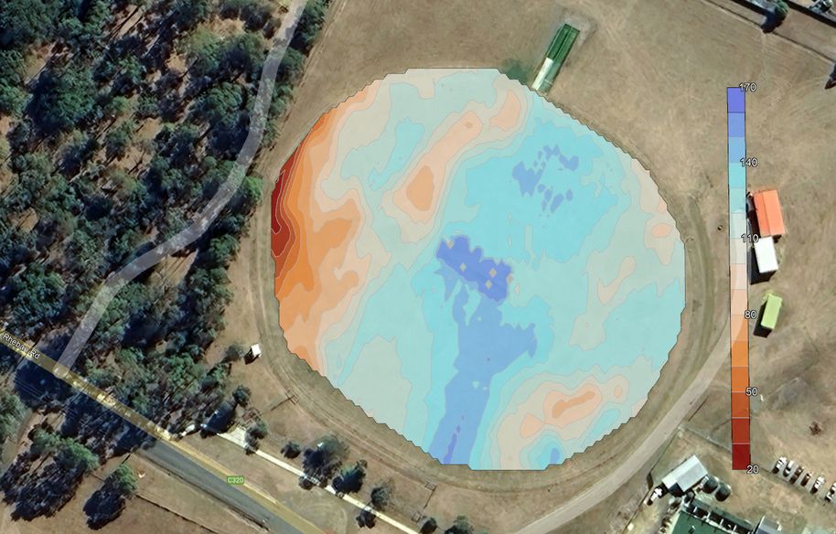
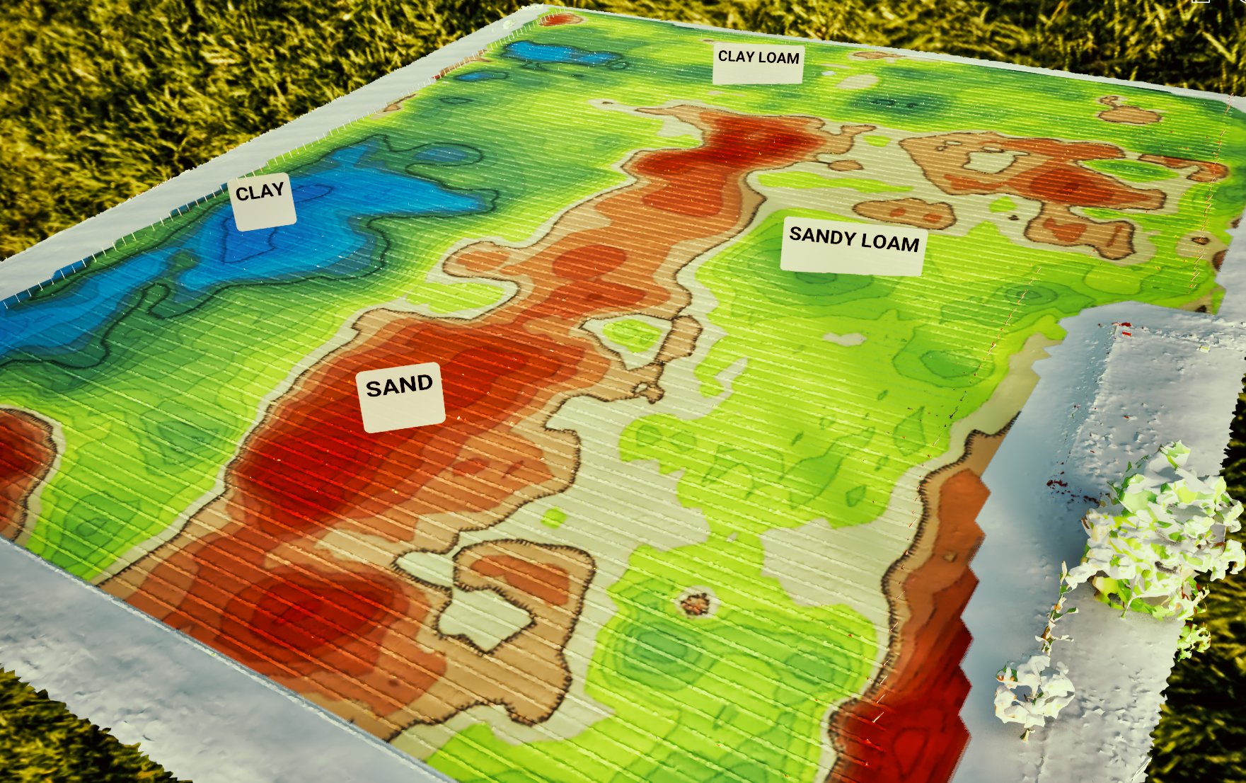
ECa apparent conductivity (mS/m) highlighting drainage patterning and soil profile variance.
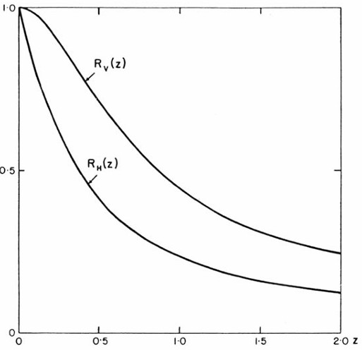
Cumulative response curves

Instrument response relativce to coil seperation
Geonics EM38 — 14.6 kHz, 1 m coil separation, GPS-integrated for real-time georeferenced ECa acquisition
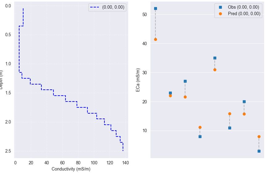
Multi-layer forward model — observed vs predicted ECa minimised to solve for depth profile
EMI Device
Operation
Multi-coil configurations in vertical and horizontal dipole modes provide multiple depth windows from a single pass. GPS-integrated for real-time georeferenced ECa acquisition.
ECa is the cumulative sum of all layers multiplied by their respective conductivities. A reading of 100 mS/m could represent two 100 mS/m layers or an upper 80 mS/m layer with a 160 mS/m lower layer. The forward model minimises misfit between observed and predicted values to resolve the depth profile.