Turfgrass
Management
ECa Mapping · Salinity · Variable-Rate Irrigation · Golf Course Management
Beyond
Blanket Applications
Golf course superintendents typically base irrigation programs on visual observations and weather forecasts — often resulting in blanket applications that waste water and damage playability. Soil moisture on fairways is highly spatially variable, meaning uniform irrigation over- and under-waters simultaneously.
Precision Turfgrass Management (PTM) is an emerging approach using georeferenced ECa surveys and GIS to delineate site-specific management zones — enabling targeted input application that improves quality while cutting resource costs.
ECa has an inverse relationship with plant nitrogen uptake — making it a direct indicator of turfgrass quality and soil pH across the fairway.
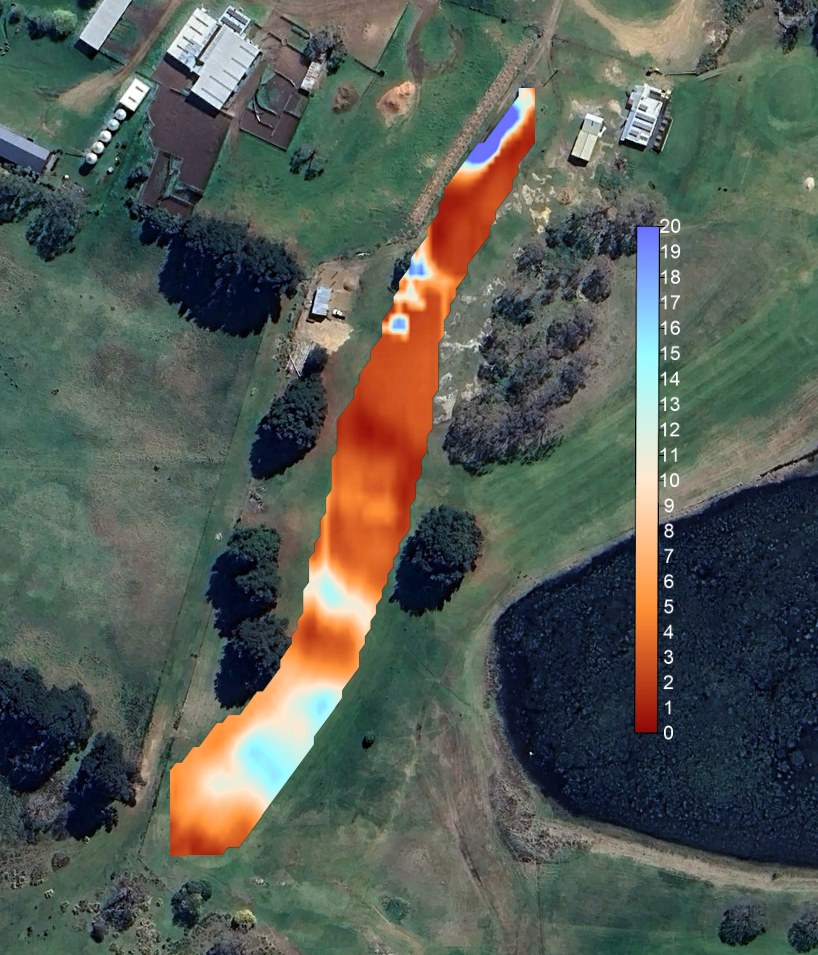
Fairway ECa map — warm tones indicate elevated conductivity (saline or clay-rich); cool zones reveal sandy, lower-conductivity areas requiring different irrigation regimes
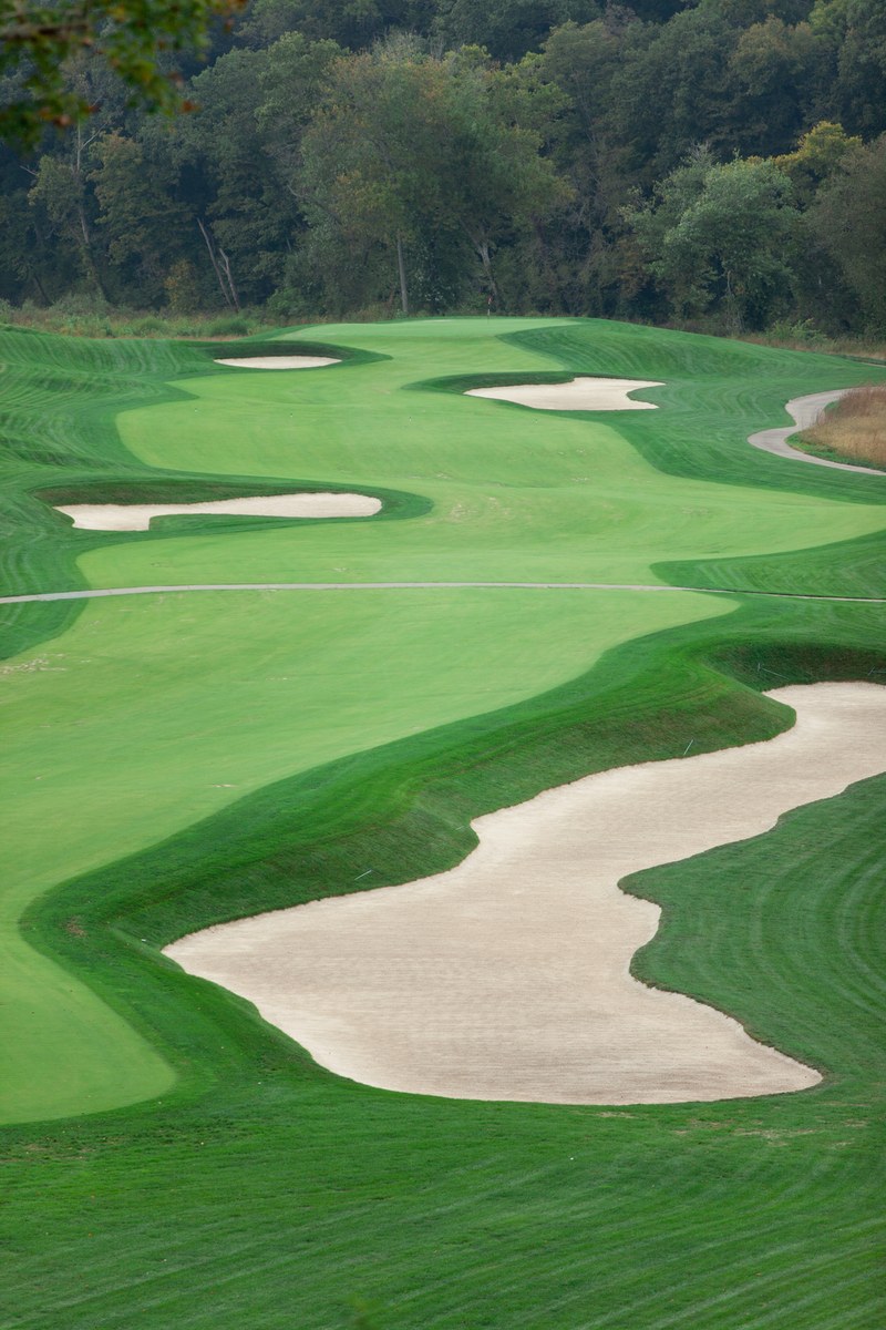
Sand-capped fairway — uniform texture class improves drainage and playability, but creates localised dry spots that demand precision irrigation management
Why Sand-Capped
Fairways Need PTM
Sand capping provides a more uniform soil textural class with increased drainage and better playability after rainfall. However, it introduces higher water and nutrient application requirements — and critically, localised dry spots that blanket irrigation cannot address.
A uniform sand profile improves water infiltration and salt management, but the same uniformity that helps drainage also means spatial variability from beneath drives uneven turfgrass performance — invisible from the surface until quality declines.
| ECa Relationship | Indicator |
|---|---|
| Inverse with N uptake | High ECa = reduced nitrogen availability to plant |
| Correlated with pH | ECa maps proxy for soil pH spatial variation |
| Salinity proxy | Elevated ECa = salt stress zones requiring leaching |
| Moisture indicator | Low ECa sandy areas = localised dry spot risk |
Salt Stress on
Turfgrass Roots
In saline soils, salt reduces the osmotic pressure gradient between soil and root — restricting the flow of water into the plant and reducing the water available for growth and playability.
Even irrigation with nominally 'fresh' water (20 mS/m) contributes approximately 1,088 kg of salt per hectare per season. Without active management, salt accumulation progressively degrades turf quality.
- —Irrigation water — cumulative salt load even from fresh water sources
- —Groundwater & water tables — rising saline groundwater intrusion
- —Ocean-derived salts — coastal courses particularly vulnerable
- —Fertilisers & cleaning agents — sodium hypochlorite in drip systems adds to salt load
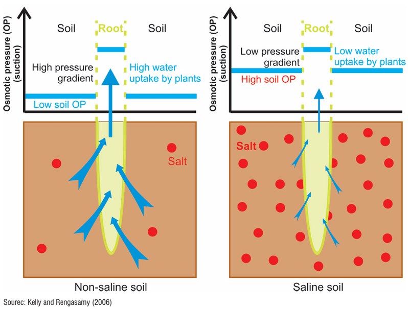
Osmotic pressure comparison — non-saline soil (left) maintains pressure gradient for water uptake; saline soil (right) reduces gradient, starving roots
Root Zone to
Sub-Profile
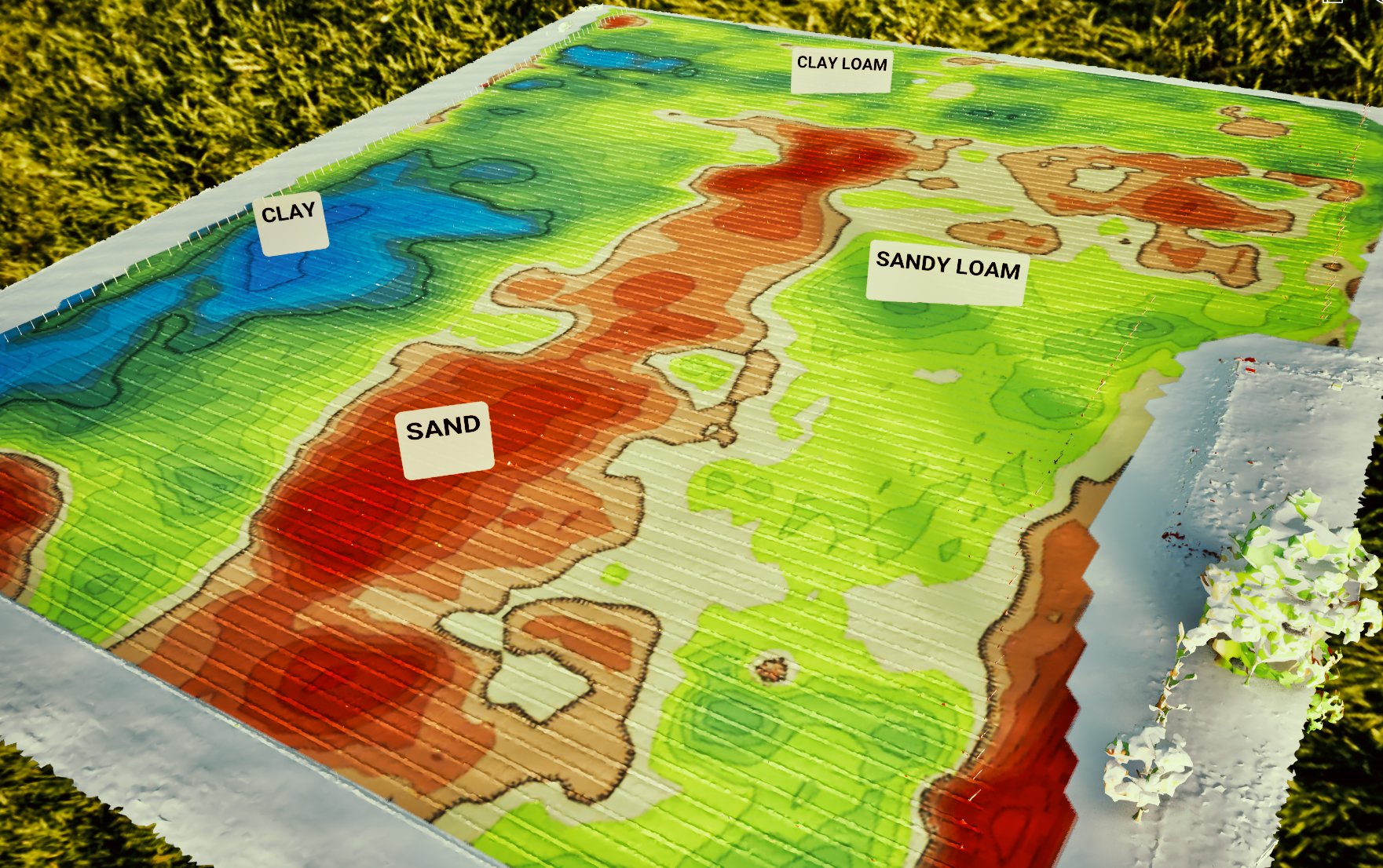
Simultaneous vertical and horizontal dipole readings provide shallow root zone (~75 cm) and full-profile (~150 cm) conductivity layers in a single pass — revealing whether salinity is concentrated at the surface or accumulating in deeper layers.
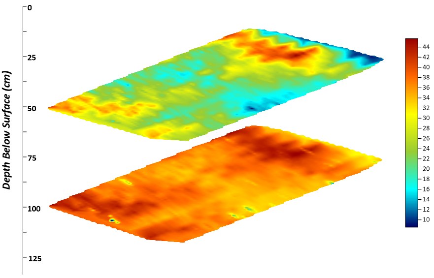
Multi-depth ECa profiles — shallow layer (top) vs deep layer (bottom) reveals vertical salinity stratification below the fairway surface
What You
Receive
- GPS-integrated EM38 at 5 readings/sec
- Vertical & horizontal dipole — two depth windows
- Swath spacing 2–10 m for fairway resolution
- Shallow and deep ECa gridded layers
- Salinity risk and dry spot delineation
- Variable-rate irrigation prescription maps
- Zone-by-zone interpretation and recommendations
- Leaching targets for salt-affected areas
- Seasonal monitoring framework